I-375 Settlement Monitoring
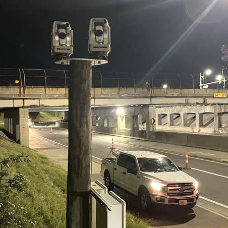
Monitoring I-375 for Settlement I-375 was closed for two nights to allow installation of the instruments. Four AMTS units provided continuous monitoring for settlement of the road surface and bridge during installation of an underground power transmission line. Project The project involved horizontal directional drilling below I-375 to place an underground power transmission line. The…
Read MoreGross Reservoir Expansion
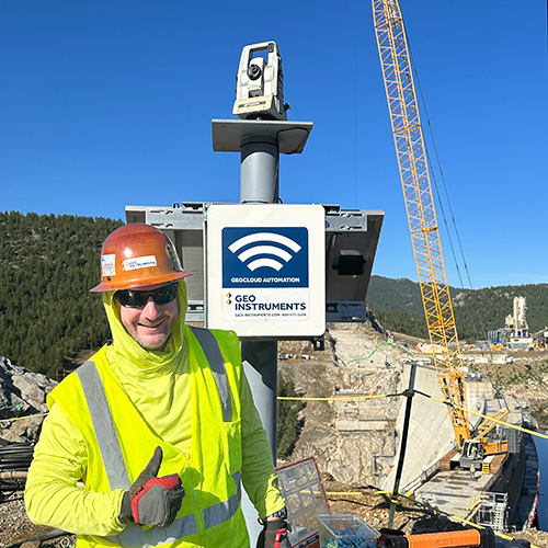
Projects ProjectsRecentSettlementExcavationsStructuresWalls & SlopesInfrastructureBridgesTunnelsRailMinesVibrationConsolidationPiles Gross Reservoir Expansion The Project Denver Water’s Gross Reservoir Expansion Project will add 131 feet to the height of the dam, triple the volume of the reservoir, and convert the original concrete gravity structure to a concrete arch structure that can support the expanded capacity. See the video below for more…
Read MoreTexas Capitol Complex
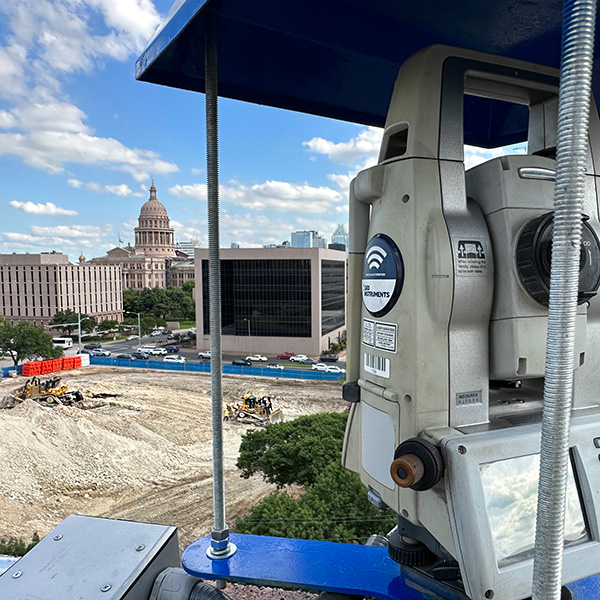
Projects ProjectsRecentSettlementExcavationsStructuresWalls & SlopesInfrastructureBridgesTunnelsRailMinesVibrationConsolidationPiles Texas Capitol Complex Expansion Capitol Complex Phase 1 Phase 1 included construction of two state office buildings and a five-level underground parking garage topped with a landscaped pedestrian mall. Phase 1 required an extensive support of excavation program. The excavation footprint exceeded 10 acres with an average depth of 60 feet…
Read MoreSpokane River Bridge
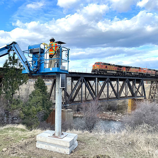
Spokane River Bridge The BNSF Spokane River Bridge project involves construction of a new rail bridge adjacent to the existing bridge. Geo-Instruments is monitoring the existing bridge for potential impacts from the construction, which includes vibratory pile driving for a temporary pile-supported work trestle. GEO deployed three automated monitoring systems that separately report displacements, vibration,…
Read MoreTrack Monitoring – Chicago
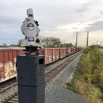
Automated Track Monitoring – Chicago This AMTS system was used to monitor for potential settlement and lateral movement of twin rails during jack boring operations beneath the rail embankment. The project duration was 10 months. The AMTS was mounted on a tower for good sight lines to rail-clip prisms installed on the tracks. The height…
Read More6th Street Viaduct

6th Street Viaduct GEO-Instruments worked with Skanska and Cowi during the construction of the new multi-arch 6th Street Viaduct in Los Angeles. The 3500-foot long viaduct crosses over 16 lanes of highway, 18 sets of railroad tracks, the LA river, parks, buildings, and sidestreets. The bridge deck was initially supported by formwork. After the arches…
Read MoreTrack Monitoring Test
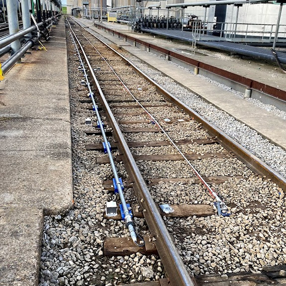
Projects ProjectsRecentSettlementExcavationsStructuresWalls & SlopesInfrastructureBridgesTunnelsRailMinesVibrationConsolidationPiles Track Monitoring Comparison Test Shape array – red AMTS prisms – orange Tiltmeters – green In-Place Inclinometer – blue GEO-Instruments has posted a paper that discusses three track monitoring technologies. The three technologies are: AMTS, Shape Arrays, and Tiltmeters. Will there be a clear winner? AMTS (automated total stations) monitor the…
Read MoreSOE in Seattle
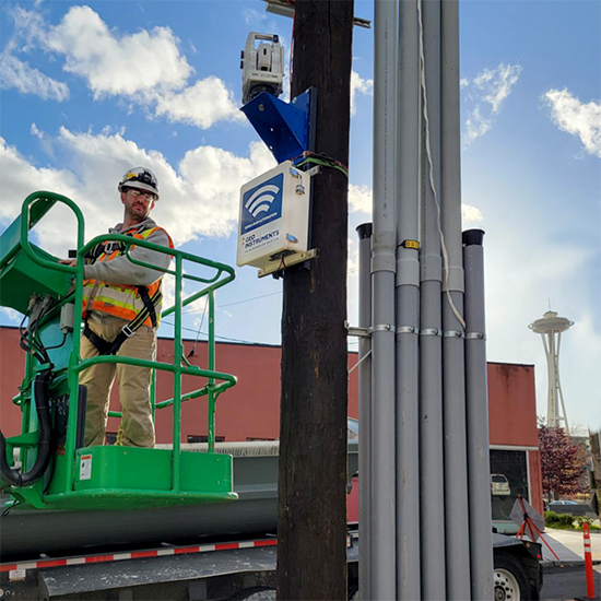
Monitoring SOE in Seattle GEO-Instruments is monitoring the support of excavation system at 701 Dexter in Seattle. The deep excavation makes room for a 4-level underground parking garage that will be topped by a 10-story office building. At the start of the project, the 701 Dexter building was still standing. GEO used a drone to…
Read MoreCoastal Cliff Erosion
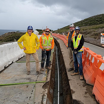
Projects ProjectsRecentSettlementExcavationsStructuresWalls & SlopesInfrastructureBridgesTunnelsRailMinesVibrationConsolidationPiles Coastal Cliff Erosion Threatens Road Coastal erosion threatens the safety of a road leading to an industrial site. At this location, the cliff has advanced inland to within 20 feet of the road. A 600-foot horizontal shape array, piezometers, and vibration monitors were installed to provide continuous monitoring. The cliff has…
Read MoreCo-Located Instruments
News Archive Co-Located Tiltmeters & Prisms GEO-Instruments installed wireless tiltmeters and AMTS prisms to monitor repairs to a highway embankment supported by MSE walls. In some cases, the tiltmeters and AMTS survey prisms were co-located. The graphs above show close tracking of tiltmeter and prism measurements over a 3 month period. The red limit lines…
Read More