ElastiSense Displacement Sensors
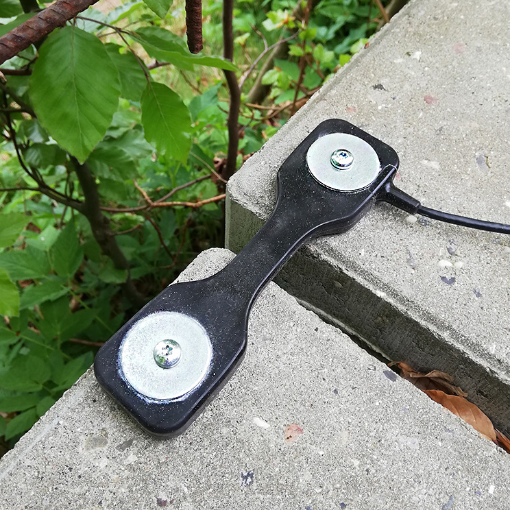
News Archive New: ElastiSense Displacement Sensors These rugged sensors are ideal for monitoring cracks and joints in bridges, tunnels, buildings, dams, retaining walls, and even rock faces. Extreme Durability Flexible, waterproof, immune to misalignments, heat, cold, dirt, dust, chemicals, and vibrations. Easy Installation Low profile, no special mounting, no protection, no maintenance, and compatible with…
Read MoreBridge Monitoring with GNSS
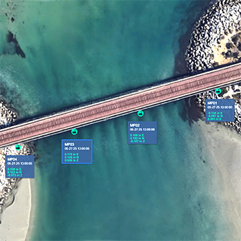
Bridge Monitoring with GNSS Locator One GNSS sensors can be installed quickly and are fully autonomous: no cables, no power supplies, no gateways, no protective housings, and no maintenance. Locator One GNSS sensors use signals from GNSS satellites to monitor displacements in 3D with an averaged precision of ±2mm horizontal and ±4 mm vertical. Locator…
Read MoreMonitoring Soil Consolidation with Locator One
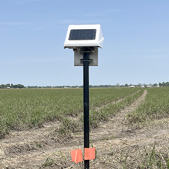
Monitoring Settlement with Locator One The Project An industrial structure will be sited on land that was previously used for farming. The soft ground is undergoing consolidation with wickdrains and a surcharge to improve its bearing strength and stability. Monitoring Requirements The progress of consolidation will be monitored using settlement plates. Specifications require weekly surveys…
Read MoreMonitoring Water Quality
Monitoring Water Quality The Project GEO is monitoring a construction project adjacent to a waterway. The project required water quality monitoring as well as the standard geotechnical monitoring. Monitoring Requirements The water quality parameters included pressure, water temperature, dissolved oxygen, pH, conductivity, and turbidity. Measurements were to be obtained at 1 to 6 hour intervals.…
Read MoreEWS Satellite Loggers
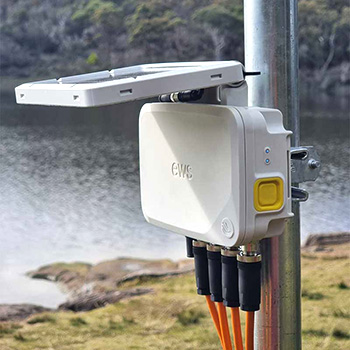
News Archive New: EWS Satellite Loggers EWS satellite loggers are compact, battery-operated devices with built-in satellite connectivity certified by the Iridium Satellite Network. Measurements sent from EWS loggers in the field can be viewed just minutes later on office and mobile web browsers. EWS loggers are designed for easy deployment. Their all-in-one design eliminates the…
Read MoreLocator One GNSS Sensors
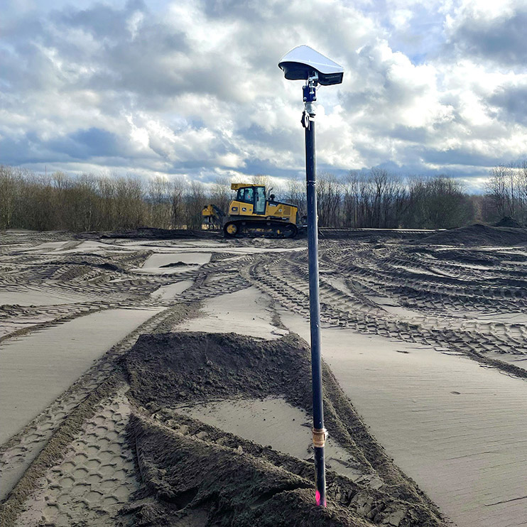
News Archive New: Locator One GNSS Sensors Locator One GNSS Sensors Locator One GNSS sensors use satellite signals to monitor settlement and lateral displacements. GEO-Instruments is deploying these sensors on its own projects and has them available as rentals. Locator One Applications Automating measurements of settlement plates. Monitoring slope stability at open pit mines, tailings…
Read MoreI-375 Settlement Monitoring
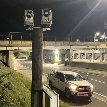
Monitoring I-375 for Settlement I-375 was closed for two nights to allow installation of the instruments. Four AMTS units provided continuous monitoring for settlement of the road surface and bridge during installation of an underground power transmission line. Project The project involved horizontal directional drilling below I-375 to place an underground power transmission line. The…
Read MoreGross Reservoir Expansion
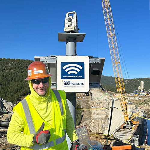
Projects ProjectsRecentSettlementExcavationsStructuresWalls & SlopesInfrastructureBridgesTunnelsRailVibrationDustConsolidationPiles Gross Reservoir Expansion The Project Denver Water’s Gross Reservoir Expansion Project will add 131 feet to the height of the dam, triple the volume of the reservoir, and convert the original concrete gravity structure to a concrete arch structure that can support the expanded capacity. See the video below for more…
Read MoreTexas Capitol Complex
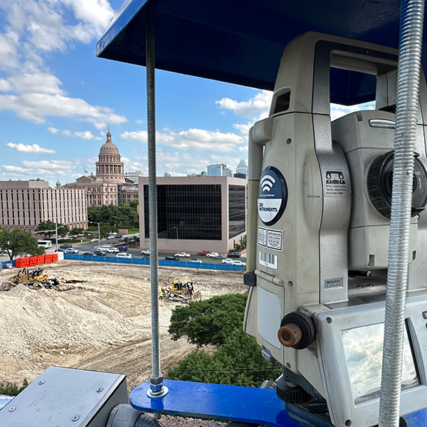
Projects ProjectsRecentSettlementExcavationsStructuresWalls & SlopesInfrastructureBridgesTunnelsRailVibrationDustConsolidationPiles Texas Capitol Complex Expansion Capitol Complex Phase 1 Phase 1 included construction of two state office buildings and a five-level underground parking garage topped with a landscaped pedestrian mall. Phase 1 required an extensive support of excavation program. The excavation footprint exceeded 10 acres with an average depth of 60 feet…
Read MoreSpokane River Bridge
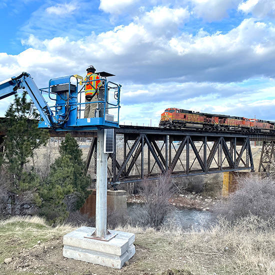
Spokane River Bridge The BNSF Spokane River Bridge project involves construction of a new rail bridge adjacent to the existing bridge. Geo-Instruments is monitoring the existing bridge for potential impacts from the construction, which includes vibratory pile driving for a temporary pile-supported work trestle. GEO deployed three automated monitoring systems that separately report displacements, vibration,…
Read More