projects
Bridge Monitoring with GNSS
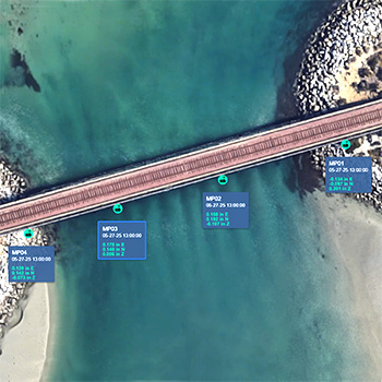
Bridge Monitoring with GNSS Locator One GNSS sensors can be installed quickly and are fully autonomous: no cables, no power supplies, no gateways, no protective housings, and no maintenance. Locator One GNSS sensors use signals from GNSS satellites to monitor displacements in 3D with an averaged precision of ±2mm horizontal and ±4 mm vertical. Locator…
Read MoreMonitoring Soil Consolidation with Locator One
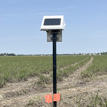
Monitoring Settlement with Locator One The Project An industrial structure will be sited on land that was previously used for farming. The soft ground is undergoing consolidation with wickdrains and a surcharge to improve its bearing strength and stability. Monitoring Requirements The progress of consolidation will be monitored using settlement plates. Specifications require weekly surveys…
Read MoreMonitoring Water Quality
Monitoring Water Quality The Project GEO is monitoring a construction project adjacent to a waterway. The project required water quality monitoring as well as the standard geotechnical monitoring. Monitoring Requirements The water quality parameters included pressure, water temperature, dissolved oxygen, pH, conductivity, and turbidity. Measurements were to be obtained at 1 to 6 hour intervals.…
Read MoreI-375 Settlement Monitoring
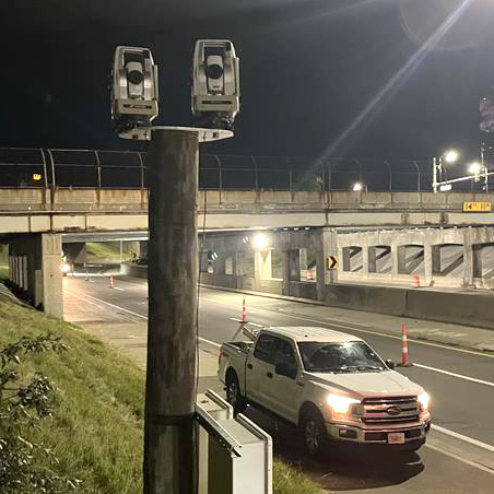
Monitoring I-375 for Settlement I-375 was closed for two nights to allow installation of the instruments. Four AMTS units provided continuous monitoring for settlement of the road surface and bridge during installation of an underground power transmission line. Project The project involved horizontal directional drilling below I-375 to place an underground power transmission line. The…
Read MoreGross Reservoir Expansion
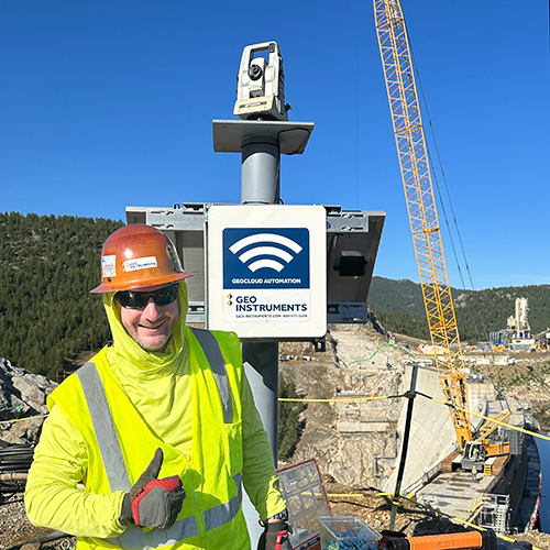
Projects ProjectsRecentSettlementExcavationsStructuresWalls & SlopesInfrastructureBridgesTunnelsRailVibrationDustConsolidationPiles Gross Reservoir Expansion The Project Denver Water’s Gross Reservoir Expansion Project will add 131 feet to the height of the dam, triple the volume of the reservoir, and convert the original concrete gravity structure to a concrete arch structure that can support the expanded capacity. See the video below for more…
Read MoreTexas Capitol Complex
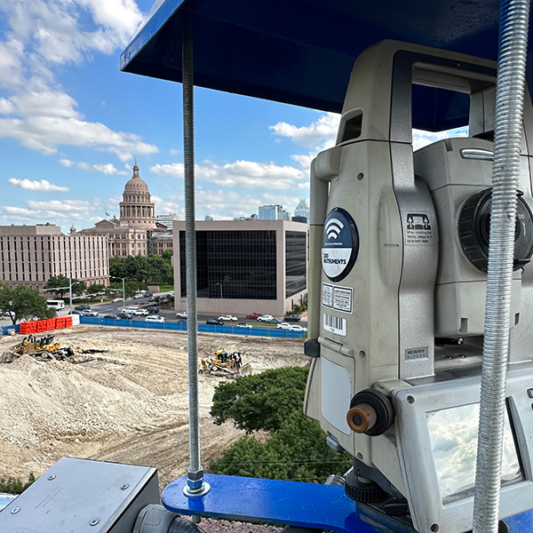
Projects ProjectsRecentSettlementExcavationsStructuresWalls & SlopesInfrastructureBridgesTunnelsRailVibrationDustConsolidationPiles Texas Capitol Complex Expansion Capitol Complex Phase 1 Phase 1 included construction of two state office buildings and a five-level underground parking garage topped with a landscaped pedestrian mall. Phase 1 required an extensive support of excavation program. The excavation footprint exceeded 10 acres with an average depth of 60 feet…
Read MoreSpokane River Bridge
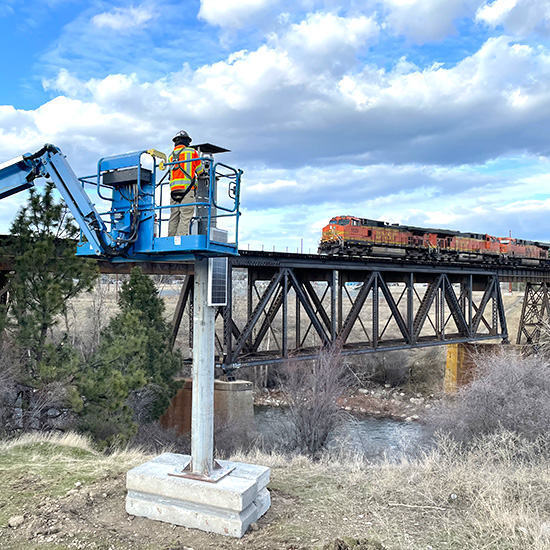
Spokane River Bridge The BNSF Spokane River Bridge project involves construction of a new rail bridge adjacent to the existing bridge. Geo-Instruments is monitoring the existing bridge for potential impacts from the construction, which includes vibratory pile driving for a temporary pile-supported work trestle. GEO deployed three automated monitoring systems that separately report displacements, vibration,…
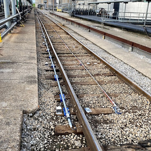
Read MoreTrack Monitoring – Chicago
Automated Track Monitoring – Chicago This AMTS system was used to monitor for potential settlement and lateral movement of twin rails during jack boring operations beneath the rail embankment. The project duration was 10 months. The AMTS was mounted on a tower for good sight lines to rail-clip prisms installed on the tracks. The height…
Read More6th Street Viaduct

6th Street Viaduct GEO-Instruments worked with Skanska and Cowi during the construction of the new multi-arch 6th Street Viaduct in Los Angeles. The 3500-foot long viaduct crosses over 16 lanes of highway, 18 sets of railroad tracks, the LA river, parks, buildings, and sidestreets. The bridge deck was initially supported by formwork. After the arches…
Read MoreTrack Monitoring Test
Projects ProjectsRecentSettlementExcavationsStructuresWalls & SlopesInfrastructureBridgesTunnelsRailVibrationDustConsolidationPiles Track Monitoring Comparison Test Shape array – red AMTS prisms – orange Tiltmeters – green In-Place Inclinometer – blue GEO-Instruments has posted a paper that discusses three track monitoring technologies. The three technologies are: AMTS, Shape Arrays, and Tiltmeters. Will there be a clear winner? AMTS (automated total stations) monitor the…
Read More