projects
Renovation of Apple Store
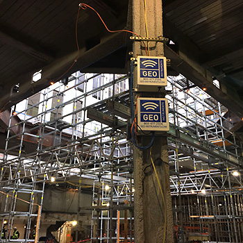
Renovation of Apple Store GEO deployed wireless data loggers, strain gauges, and an AMTS system. GEO monitored renovation work at the iconic glass cube Apple store in New York City. A critical phase of the renovation was the controlled release of tension in a pretensioned steel structure. Instrumentation included vibrating wire strain gauges to monitor the…
Read MoreBulkhead Stability
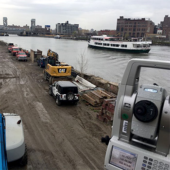
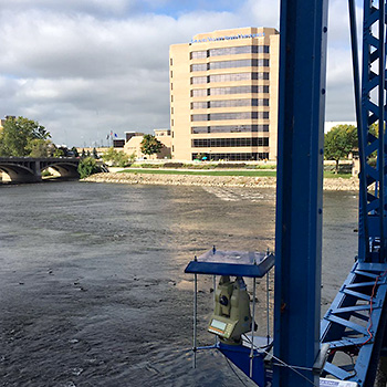
Bulkhead Stabilty GEO monitored a bulkhead along Harlem River in advance of construction of piers for a new bridge. Instrumentation included an AMTS monitoring system and automated vibration monitors.
Read MoreTunnels & Structures

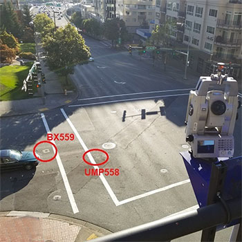
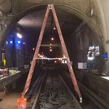
Tunnel Construction & Surface Points GEO monitored an existing train tunnel as work proceeded on a new sewer tunnel. The AMTS in the photo was monitoring surface points, while another AMTS was monitoring within the tunnel. Other instrumentation included shape arrays, piezometers, extensometers, and automated vibration monitors.
Read MoreTunnelling & Settlement
Tunneling & Settlement Monitoring The Bellevue tunnel was aligned with a major thoroughfare. To monitor possible settlements, GEO-Instruments installed borehole extensometers above the tunnel centerline and arrays of road prisms across the road. Photo shows installation of a road prism. Borehole extensometers were terminated flush with the surface using a LidLink antenna. Measurements were transmitted…
Read MoreSlope Stabilization
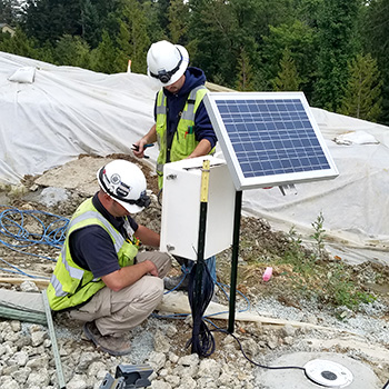
Slope Stabilization At this slope stabilization project, GEO installed twelve shape arrays at depths from 40 to 90 feet, eight vibrating wire piezometers, and monitoring equipment for dewatering pumps. All of the solar-powered installations sent measurements to Geocloud servers by cell modem. The drone photo at left shows the location of all 12 shape arrays. The site…
Read MoreStructural Stability
Structural Stability Project This office building required foundation improvements but had to stay open while the work was done. Requirement To ensure the safety of people inside and to comply with building codes, the structure had to be monitored for settlement and deformation. Solution GEO installed an AMTS on a foot bridge. It monitored prisms…
Read More3D Consolidation Mapping
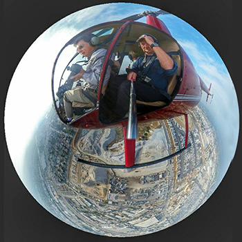
Mapping Ground ImprovementGEO used a helicopter and a GPS enabled camera to gather point cloud data for 3D monitoring of ground improvement work. The mapping successfully captured surface settlements induced by deep dynamic compaction and surcharging. More recently, the mapping process is performed more efficiently by drones.
Read MoreMetro Tunnel
DC Metro Tunnel GEO’s deployed an automated monitoring system in a WMATA tunnel. The system included strain gages, convergence gauges, tiltmeters, vibration monitors, and AMTS. The AMTS and prisms are clearly visible in the photo on the right. Also visible is one of the eight vibration monitors and wall-mounted geophones.
Read MoreTunnel & Piezometers
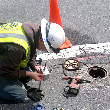
Piezometers along Tunnel Alignment Piezometers were installed in the roadway above the Bellevue tunnel alignment. The instruments were collocated with observation wells and inclinometers at 10 locations. All were automated with wireless dataloggers that were capable of transmitting data through the inspection plates. Piezometer readings were transmitted hourly and displayed on a dedicated project website.…
Read MoreM-Street Excavation
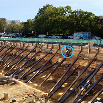
M-Street Excavation & Tunnel GEO monitored a 32-foot deep excavation and a WMATA metro tunnel adjacent to the excavation in Washington DC. The SOE consisted of drilled soldier piles braced with whalers and rakers. GEO’s technician can be seen on the wall. Monitoring prisms, a few visible in this photo, were mounted at the top…
Read More